AMGeO Model Updates
July 2025
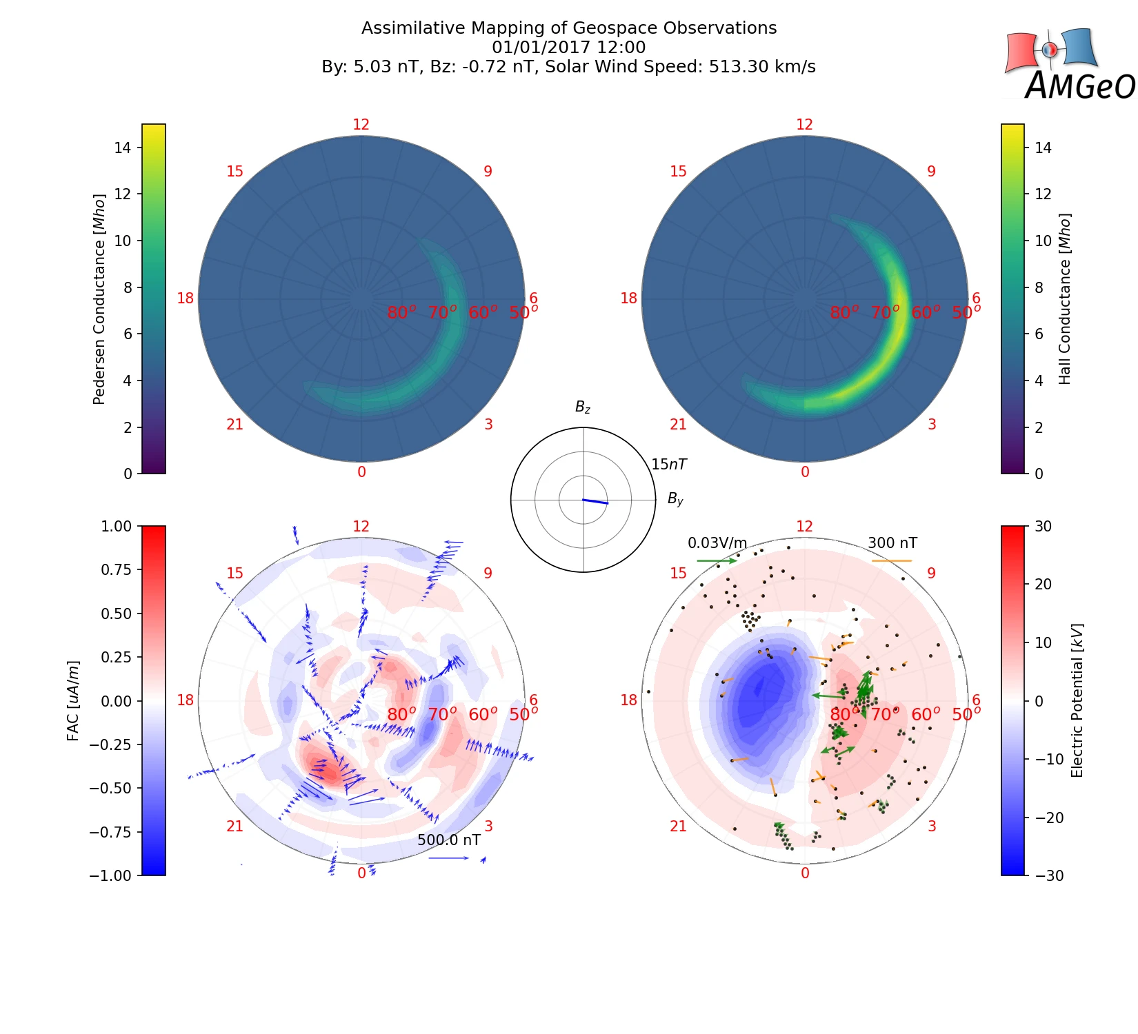
As of July 31, 2025, the Assimilative Mapping of Geospace Observations (AMGeO) model version 3.0.8 is now available to the community through the CCMC Run on Request (RoR) service.
AMGeO is a collaborative data science platform for the geospace science community for bringing together a diverse set of heterogeneous geospace observations from NSF-funded facility programs and individual community users to obtain complete maps of high-latitude ionospheric electrodynamics for scientific discovery and space weather research. It is developed at the University of Colorado Boulder by the AMGeO Team, with support from the NSF Earth Cube program.
AMGeO is working with data obtained from SuperDARN, SuperMAG, and AMPERE. First-time users who request a run with SuperDARN or AMPERE data must register on the respective project websites.